The Inca Trail to Machu Picchu
Our destination: Machu Picchu (yes, it did look like this!)
(Click on an image for the full version!)
We have to confess that at one point in our planning, we had actually decided that the Inca Trail (or Camino Inca)would take up too much time, that the 3-day hike starting at km88 near Cuzco and wending its way up and over majestic Andean peaks, down into the more tropical terrain of the Amazon basin, past Inca ruins inaccessible except on foot and culminating at Machu Picchu, the most famous ruins in all of the Americas, might not be worth the time, hassle and energy.
Pfffbt!!!! Were we nuts?
 Map of the Inca Trail |
OK, we did of course have a first-hand account from someone who said she thought she was going to die, and we had also read reports of robberies and accidents on the trail. And it wasn't exactly a cakewalk (well, not for some of us anyway): although the total length of the trail is only about 50 miles, the high elevation, especially on day 2 (when we went from 2600m to 4000m and back down to 3600m), made it quite demanding. |
 Llactapata, the first ruins along the trail, possibly a storage center for crops produced in the valley and on the hillsides. |
All in all, though, our fears were unfounded. We lucked out with an
excellent tour guide, Kenny, who not only seemed to have read
everything ever written about Machu Picchu (and Hiram Bingham!) but
also told us great stories about tiny devils appearing in the night
and jungle runways suddenly appearing between parting trees. We were
in an amiable group of 15 (fortunately only two Americans, Tien and
Nancy!) and met other pleasant fellow Inca Trailers on the way as
well.
|
We also think we might have set a record for amount of laughing on the Inca Trail, especially on the second day (well, at least Nancy and Tien), when, we like to think, our frequent outburts helped us make it to the top of Warmiwanusca (see right), the highest point on the trail at 4200m, or maybe 4000m -- conflicting reports! In the background is a long uphill stretch, and at some point down there we stopped for an orange break that stretched into a half-hour laughing fit. Our peals of laughter echoed through the valley, causing some helpful fellow trekkers to caution us against the dangers of laughing too much (and thereby squandering the precious energy we'd need to get to the top); our attempts to contain ourselves only backfired. Just as we were wondering whether indeed laughing would cause us particular difficulties at altitude, a Very Helpful Man passed by and, barely pausing, informed us that the decreased oxygen we were getting at that altitude was producing an effect similar to that of alcohol, which may hamper hemoglobin's ability to take up oxygen. In other words, he said, we were drunk on altitude! By the time we recovered from the new laughing fit inspired by this, he was gone, so it wasn't until later that we had a chance to break it to him that we actually laugh this much even at sea level. He was eventually dubbed the M&M guy (in dark blue to the left of the picture), since when we caught up to him he tempted us up the steep trail with the promise of M&Ms. |
 "Vamos, muchachitos!" Our guide Kenny near Runkuraqay. The path snaking down the hill was what we came down on day 2, after reaching the peak at Warmiwanusca; we camped near the small white hut in the valley in a place called Pacaymayu. |
The third day had it all: four sets of ruins, two passes that rewarded us with amazing views for the effort of getting there, a dramatic ecological swing from the drier and more barren puna to the thick vegetation and constant background hum of jungle life. (We also had as destination a more civilized campsite at Winaywayna to look forward to: bathrooms and showers!)
 Nancy, Tien and Rachel at Runkuraqay (Quecha for "round house"), probably a look-out post. |
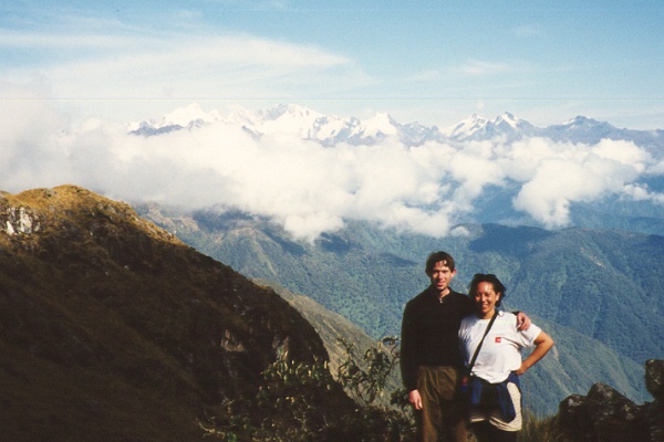 Kevin and Nancy near Runkuraqay. Notice the snow-covered Andean peaks in the distance. |
 Tien and Nancy and the end of a path that seemed to lead nowhere -- steep cliff beyond! |
| Our final day began even earlier than the previous several had: around 4 a.m. we set off with flashlights in hand (or on head, for some) through the thick fog to make it to Inti Punku (the Sun Gate) in time for what we hoped would be a spectacular sunrise and first glimpse of our ultimate goal. We arrived at the gate to find instead a spectacular view of thick grey fog and a number of rather disappointed looking hikers! We waited hopefully for some time, but after a few false alarms (a slightly lighter grey patch of sky caused much excitement) we gave up and started down the path toward our goal. The tension mounted as we descended; a slight breeze tantalized us with glimpses of splendors natural and man-made perpetually receding behind the grey curtain. (One defiant peak seemed to proclaim, "I'm a mountain, a mountain!" as it poked through the mist; more laughing fits.) Fortunately, before long the sun burned away most of the mist, unleashing a clear blue sky for our sunbathing pleasure and a vast archaelogical treasure worthy of its reputation. |
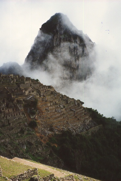 |
Our first glimpse of Machu Picchu finally emerging
from the mist. |
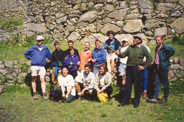 The whole group with our local Machu Picchu guide, Francisco. |
Kenny was not allowed to show us around Machu Picchu, for reasons he was too embarassed to explain. Fortunately, our local guide Francisco (como Francisco Pizarro!) provided much melodramatic entertainment: "Open your eyes WIDE!" he would exhort us, to the amazing skills of the Inca masons. Some vegetation around the site, he told us, was highly recommended "if you want to FLY HIGH!" He made the most amazing hooting sounds when trying to demonstrate some acoustic effect in one chamber (somewhat less impressive because everyone could hear it), and, in insisting that we take advantage of his recommended photo ops, demanded sternly, "Give me your camera!" |
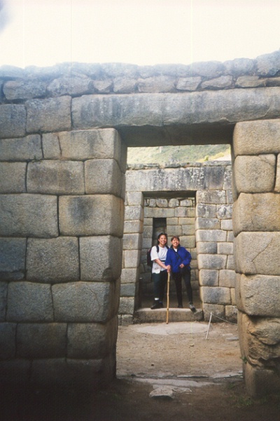 Nancy and Tien after complying with Francisco's command. |
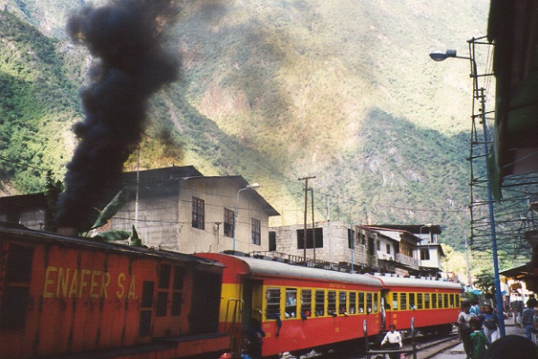 Our train back from Aguas Calientes. |
We found out while at the site that the local train back to Cuzco had been canceled because a landslide had closed off a section of the tracks. Fortunately, we had tickets for the express train, which meant we were able to get to Ollyantaytambo, and Kenny, which meant we were able to get back by bus to Cuzco. Too exhausted for a night on the town, we collapsed in preparation for another early morning, this time to catch our flight to Puerto Maldonado. | |
| Back to main Peru page | Onward to the jungle! |